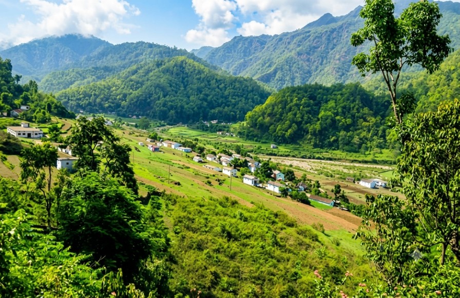
Patalkot Valley
A horseshoe-shaped depression cut nearly 1,700 feet into the Satpura plateau, sustaining the Doodhi River and the forest-based settlements of the Bharia and Gond communities. This reference outlines the terrain, seasonality, and access relevant to circuit planning in central India.
Terrain & character
Patalkot sits within the Chhindwara district of Madhya Pradesh, formed as a horseshoe-shaped depression in the Satpura range. Its cliff-encircled basin, dense sal and teak cover, and the meandering Doodhi River at its floor give the valley a topography distinct from the plateaus and hill stations that surround it. Local tradition links the site's name to "Patal Lok," the netherworld of Hindu cosmology — a reference to both its physical depth and its long-held air of mystery.
The valley's floor and slopes remain home to the Bharia and Gond communities, whose settlements, subsistence farming, and traditional knowledge of medicinal forest plants reflect patterns of habitation that have persisted with limited external contact. This combination of geological rarity, ecological density, and sustained indigenous presence places Patalkot outside the conventional hill-station or wildlife-park category, and closer to a living cultural-geographic site.
Points of reference
Rated & Raigarh
Elevated vantage points along the valley rim, offering panoramic views into the horseshoe depression. Visibility is sharpest in clear, dry-season conditions.
Doodhi River
Runs through the valley floor, sustaining tribal settlements and the surrounding vegetation. Flow and access conditions shift markedly with the monsoon.
Bharia hamlets
Scattered mud dwellings and farming plots across the valley floor, representing one of the more intact examples of forest-based tribal living in the region.
Satpura Tiger Reserve fringe
The valley's forest cover connects into the broader Satpura landscape, supporting varied flora and fauna alongside long-used medicinal plant species.
On-ground activity
Trekking & descent
Guided trails lead from the rim down into the valley floor, reaching the tribal hamlets and riverside terrain. Local guides familiar with the terrain are effectively required, given the steepness and limited signage.
Cultural interaction
Visits to Bharia settlements, conducted respectfully, offer exposure to herbal medicine practices and forest-based livelihoods sustained across generations.
Photography
Rim viewpoints provide the clearest vantage on the horseshoe formation, with early-morning mist often settling into the depression.
Nature observation
The surrounding Satpura forest belt supports varied birdlife and occasional wildlife sightings beyond the valley's geological draw.
Seasonality
| Period | Conditions | Notes |
|---|---|---|
| OCT — MAR | Recommended | Moderate temperatures, clear rim visibility, manageable descent conditions. |
| JUL — SEP | Monsoon | Lush cover and a swollen Doodhi River; trails are steep and can turn slippery. |
| APR — JUN | Low season | Higher heat on the surrounding plateau; the valley's depth offers some natural cooling. Fewer visitors on-site. |
Access & connectivity
Nearest major air connectivity, with domestic flight links.
Connected to Nagpur, Jabalpur, and Bhopal by rail.
Winding hill roads via Tamia; best paired with Satpura and Tamia hill-station itineraries.