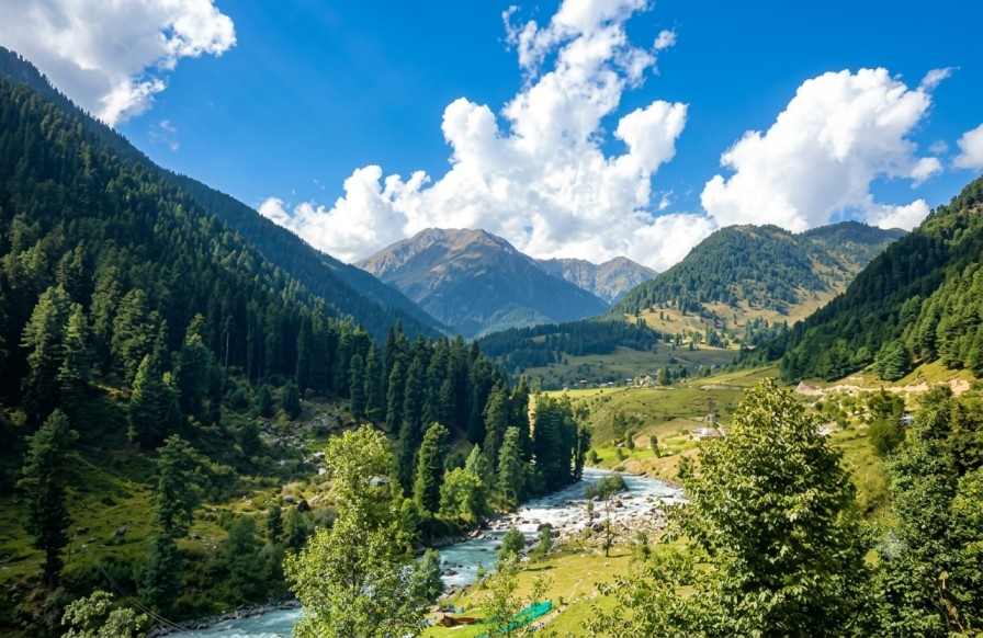
Trekking Gateway — Pir Panjal Range
Aru Valley,
where the Lidder begins.
A twelve-kilometre approach from Pahalgam opens onto alpine meadows, pine and fir forest, and the launch point for the Kolahoi Glacier and Tarsar-Marsar Lakes treks — reference data below for itinerary planning.
Overview
Aru Valley sits in the Pir Panjal range, roughly 12 km from Pahalgam in the Anantnag district of Jammu & Kashmir. The hamlet combines alpine meadows, pine forest, and snow-fed streams, and functions as one of the region's principal base points for high-altitude trekking and nature-focused itineraries.
The valley is framed by the Lidder River and bordered by pastures used by local Gujjar and Bakarwal shepherds, giving the landscape a working pastoral character alongside its scenic value. This combination of accessible terrain, village life, and trek access sets it apart from more commercialised hill stations in the region.
Aru, Anantnag district
Jammu & Kashmir, India
TERRAIN
Alpine meadow · conifer forest
glacial river valley
RIVER SYSTEM
Lidder River (glacier-fed)
Key highlights
Aru meadows
Expansive grassy stretches bordered by forested slopes, used for walks, picnics, and photography, with a gentle rise toward higher vantage points.
Lidder River
Glacier-fed water moving through rocky banks and open grass, forming the valley's central natural feature and a consistent visual anchor for itineraries.
Conifer forest belt
Dense pine and fir cover with shaded trails and varied birdlife, bordering the meadows on multiple sides of the valley.
Kolahoi Glacier trek
Multi-day route originating at Aru, reaching high-altitude glacial terrain beneath Kolahoi peak.
Tarsar-Marsar Lakes
A twin high-altitude lake trek, reached via multi-day routes departing from the valley floor.
Pastoral grazing land
Seasonal pastures used by Gujjar and Bakarwal shepherd communities, visible along the valley's outer edges.
Activities on offer
Aru functions as the launch point for multi-day treks to Kolahoi Glacier, Tarsar Lake, and Marsar Lake, typically run with local guides for terrain and route knowledge.
Local horsemen offer short meadow rides or longer excursions to nearby viewpoints, suited to travellers seeking low-exertion access to the scenery.
Riverside and meadow camping, with clear night skies supporting stargazing away from urban light sources.
A recurring filming location for Hindi-language cinema, with morning mist, grazing livestock, and shifting afternoon light across the meadows.
Seasonality
Connectivity
| Node | Type | Distance |
|---|---|---|
| Pahalgam | Nearest town | 12 km |
| Srinagar | Regional hub / airport city | 100 km |
| Anantnag | District town | 85 km |
| Sheikh ul-Alam Intl. Airport (SXR) | Nearest airport | ~100 km |
| Jammu Tawi | Nearest major rail hub | Road transfer required |