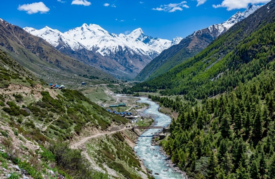
Baspa Valley
also referenced as Sangla ValleyA glacial river corridor through the Kinnaur Himalayas, tracing the Baspa River from Karcham through Sangla, Batseri, and Rakcham to Chitkul — the last inhabited village on this route before the Indo-Tibetan border. This reference outlines the route, seasonality, and access relevant to Himalayan circuit planning.
Terrain & character
Baspa Valley runs through the Kinnaur district of Himachal Pradesh along the banks of the glacial Baspa River, known locally by the name of its largest settlement, Sangla. The valley corridor is framed by deodar and pine forest, terraced apple and apricot orchards, and snow-capped ridgelines, with the river itself running in distinct turquoise and emerald tones through much of its course.
The route from Karcham to Chitkul passes through a sequence of villages — Sangla, Batseri, and Rakcham — each reflecting traditional wood-and-stone Kinnauri architecture. Chitkul, the final settlement on this stretch, sits above 11,000 feet and marks the last inhabited point on this route before the frontier, giving the valley a graduated character from cultivated lower slopes to high-altitude meadow.
Route sequence
Sangla
GATEWAY VILLAGEThe valley's principal base, offering homestays and riverside camps, with views toward the reverse face of the Kinner Kailash range from nearby points.
Kamru Fort
ABOVE SANGLAA wooden fort-temple complex once serving as the capital of the Bushahr kingdom, combining Hindu and Buddhist architectural influences with a panoramic view of the river basin.
Batseri & Rakcham
MID-VALLEYRiverside villages set among deodar forest and buckwheat farms, with wooden houses and footbridges illustrating traditional Kinnauri settlement patterns.
Chitkul
11,000+ FT · ROUTE ENDThe last inhabited village on this route before the Indo-Tibetan border, home to the Mathi Devi Temple and set among meadows and buckwheat fields facing glaciated peaks.
On-ground activity
Riverside camping
Riverbank sites near Sangla and Chitkul support overnight stays, with the Baspa River and surrounding forest providing a quiet, low-infrastructure setting.
High-altitude trekking
The valley serves as a base for the Rupin Pass, Borasu Pass, and Lamkhaga Pass routes, as well as shorter hikes such as Sangla Kanda meadow, spanning casual to technical difficulty.
Photography
River colour, orchard bloom, and shifting mountain light provide varied subject matter, with the transition to open meadow near Chitkul offering the widest visual range.
Cultural immersion
Temple and fort visits, alongside homestay stays, provide direct exposure to Kinnauri cuisine, craft, and hospitality beyond the valley's scenery.
Seasonality
| Period | Conditions | Notes |
|---|---|---|
| APR — JUN | Recommended | Moderate temperatures, open roads to Sangla and Chitkul, orchards in bloom. |
| SEP — OCT | Recommended | Crisp autumn light with continued road access; a second favourable window. |
| JUL — AUG | Monsoon | Heightened greenery and buckwheat bloom near Rakcham, offset by landslide risk on approach roads. |
| NOV — MAR | Largely closed | Heavy snowfall cuts off Chitkul and frequently Sangla; access limited to hardier winter travel. |
Access & connectivity
Nearest airport, with onward travel to the valley by taxi or bus.
Connected to Kalka via the narrow-gauge heritage line, with the journey continuing by road.
National Highway 5 to Karcham, then 18 km to Sangla and a further 28 km to Chitkul.