Loading...

Didihat : A Serene Escape In Uttarakhand

Trade Reference · Uttarakhand

Didihat, a gateway on the Kailash Mansarovar route

A geographic and operational reference on Didihat, Pithoragarh district, compiled for tour operators, DMCs and itinerary planners routing the eastern Kumaon corridor.

Elevation ~1,725 m
District Pithoragarh
From Pithoragarh 54 km
Status Sub-divisional HQ
Position on the eastern Kumaon corridor
 
Pithoragarhdistrict seat
 
Didihatsub-divisional HQ
 
Askot Sanctuarymusk deer conservation
 
Onward routetoward Kailash Mansarovar →
01 — Terrain

Landscape and geography


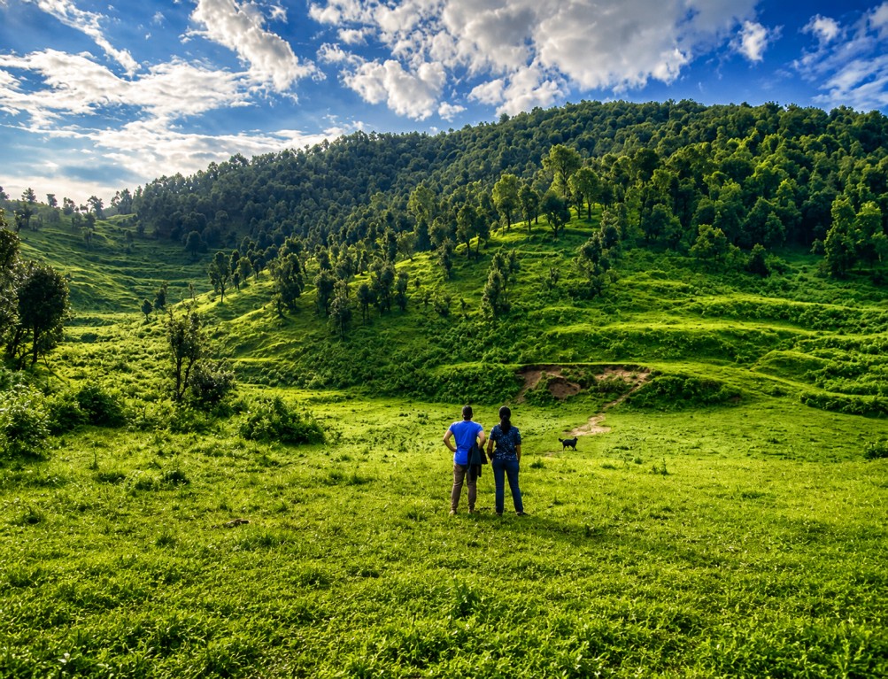
Didihat sits at approximately 1,725 metres amid forested ridges and terraced valley land, with the fertile Haat Valley spread beneath the town. Elevated points around Didihat command clear views of the Panchachuli peaks.

The town's name derives from a Kumaoni word for a small hillock, a reference to its own compact ridge-top setting within the wider eastern Kumaon terrain.

02 — Heritage

History and administrative role


Didihat functions today as a sub-divisional headquarters within Pithoragarh district, and carries visible history through scattered ancient fort remnants that point to earlier regional governance and settlement.

The nearby Sirakot Malaynath Mandir, a Shiva temple attributed to the Rajwar kings, adds a further layer of architectural and spiritual heritage. Historically, the town has also served as a staging point along the route toward Kailash Mansarovar.

03 — Sites

Key attractions


Didihat combines heritage sites within the town with a significant wildlife conservation area close by, positioning it well for combined culture-and-nature day programs.

Ancient fort remnants

Scattered ruins across the town reflecting earlier regional administration.

Sirakot Malaynath Mandir

A Shiva temple attributed to the Rajwar kings, set on a serene hillside.

Askot Musk Deer Sanctuary

A short distance from Didihat, dedicated to musk deer and other rare fauna.

Panchachuli viewpoints

Elevated positions in town offering clear, unobstructed peak views.

Haat Valley

The fertile valley beneath the town, tied to local agricultural life.

Munsiyari & Patal Bhuvaneshwar

Wider regional attractions reachable as onward stops from Didihat.

04 — Activity

Activities and experiences


Programming centres on heritage exploration and nature or village walks, with light trekking and wildlife observation available around the Askot sanctuary. Visits timed around Kumaoni Holi or Diwali add a festival dimension to the stop.

Heritage exploration Nature & village walks Light trekking Wildlife observation Festival participation
05 — Season

Seasonal reference

 
Apr — Nov

Broadly pleasant across the Pithoragarh region, warm and sunny for outdoor activity.

Oct onward

Most favoured window for sightseeing, trekking and heritage exploration.

Jan

Sharp winter chill, appealing to those seeking a high-altitude winter experience.

06 — Access

Travel logistics

 
From Pithoragarh
Approximately 54 km by road, primarily via bus and taxi services.
Rail access
Tanakpur or Kathgodam, both over 150 km away, with onward local bus or taxi.
Nearest airport
Pantnagar, roughly 244 km away; Naini Saini airstrip near Pithoragarh offers limited Delhi connectivity.
Road connections
Regular buses from Tanakpur, Almora and Haldwani, plus direct services from Delhi's Anand Vihar ISBT.