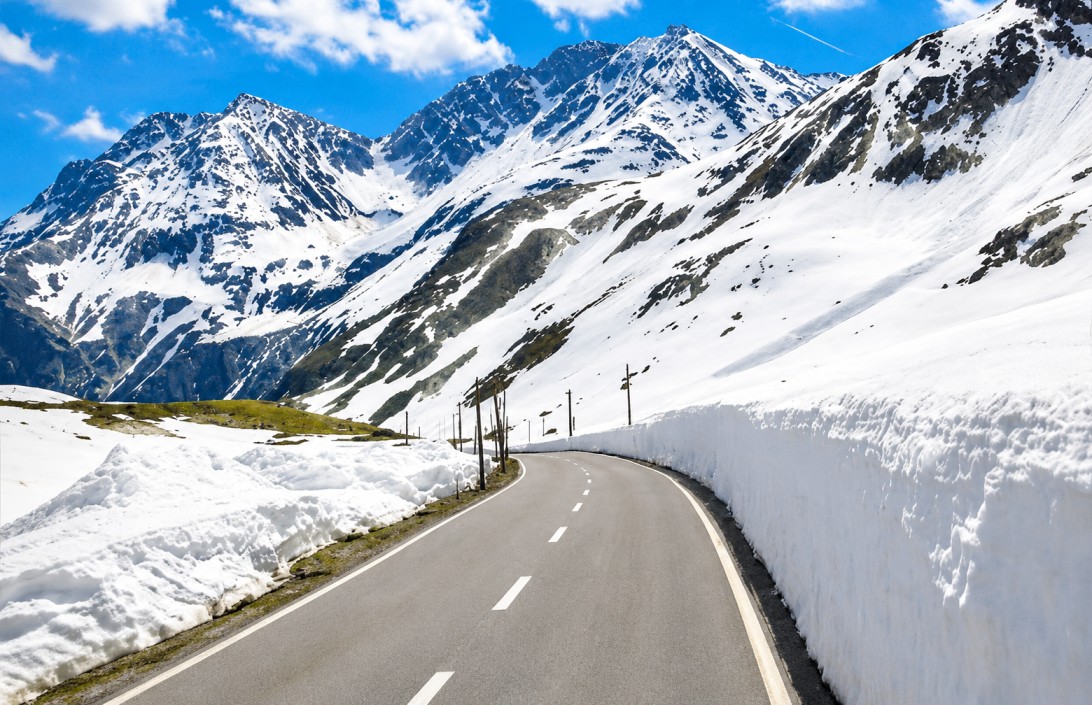
Rohtang Pass
A mountain pass at approximately 3,978 metres in the Pir Panjal range, forming the traditional crossing between the Kullu Valley and the Lahaul–Spiti region. This reference outlines the terrain, access requirements, and seasonality relevant to Himalayan circuit planning.
Online entry permit requiredTerrain & character
Rohtang Pass sits at roughly 3,978 metres, around 51 kilometres from Manali, and forms the traditional gateway between the forested Kullu Valley and the arid terrain of Lahaul and Spiti. The name is understood locally to reference the harsh conditions travellers historically faced crossing the pass, which for centuries served as a trade route linking Kullu with Lahaul, Spiti, Ladakh, and parts of Central Asia.
The Atal Tunnel now provides year-round road connectivity beneath the pass, but Rohtang itself remains a primary tourist destination in its own right, valued for its snowfields, glacier views, and the scenic mountain drive leading up to it — including the Beas Kund, understood to be the source of the Beas River.
The threshold
Approach
Forested slopes, alpine meadows, and river valley terrain leading up from Manali, with Solang Valley and Marhi as intermediate stops along the ascent.
Beyond the pass
A markedly drier, higher-altitude landscape on descent, opening into the villages and valleys of Lahaul — a distinct terrain and cultural shift from the Kullu approach.
On-route attractions
Beas Kund
Understood to be the source of the Beas River, reached via a trekking route from the Rohtang approach.
Atal Tunnel
One of the world's longest highway tunnels above 10,000 feet, providing year-round access beneath the pass toward Lahaul.
Rahala Falls & Marhi
Intermediate stops on the Manali–Rohtang drive, offering waterfall views and a common rest point along the ascent.
Solang Valley
A nearby adventure-sport valley commonly combined with a Rohtang itinerary given its position on the same approach route.
On-site activity
Snow activities
Skiing, snowboarding, snow scooter rides, sledging, tubing, and snowball play where seasonal snowfields persist, including into early summer.
Trekking & biking
Routes toward glaciers, alpine meadows, and high-altitude lakes extend from the pass and surrounding ridgelines.
Scenic drive & riding
The Manali–Rohtang road is itself a recognised route among motorcyclists, featuring winding mountain roads, waterfalls, and cliff-edge viewpoints.
Photography
Drifting cloud cover and shifting light across the snowfields and valley below make conditions highly variable through a single day.
Ecology & local context
The alpine zone around the pass supports Himalayan marmots, blue sheep (bharal), Himalayan ibex, snow partridges, and golden eagles, with lower forested elevations sheltering additional wildlife across pine, deodar, fir, and birch cover. Nearby Manali and Marhi serve regional Himachali dishes alongside momos, thukpa, and other warm fare suited to the altitude.
Access requirements
- Entry to Rohtang Pass requires an online permit under environmental access regulations.
- Altitude effects are a genuine consideration; groups should allow acclimatisation time and avoid strenuous exertion on arrival.
- Layered warm clothing, waterproof footwear, and sun protection are advisable across all visiting months.
- Vehicle access is limited to authorised taxis and tourist buses on the approach road.
Seasonality
| Period | Conditions | Notes |
|---|---|---|
| MAY — JUN | Snow present | Road open with residual snowfields still accessible for snow-based activity. |
| JUL — AUG | Monsoon | Greener surrounding landscape; road conditions can be affected by rain and landslip risk. |
| SEP — OCT | Clearest views | Clear skies and stable road conditions, favoured for sightseeing and photography. |
| NOV — APR | Closed | Heavy snowfall closes the pass to tourist traffic; the Atal Tunnel remains the year-round route beneath it. |
Access & connectivity
Nearest airport, with onward road travel via Manali to reach the pass.
Both require extended onward road travel to reach Manali and the pass.
By taxi, private vehicle, or authorised tourist bus along the scenic mountain road.