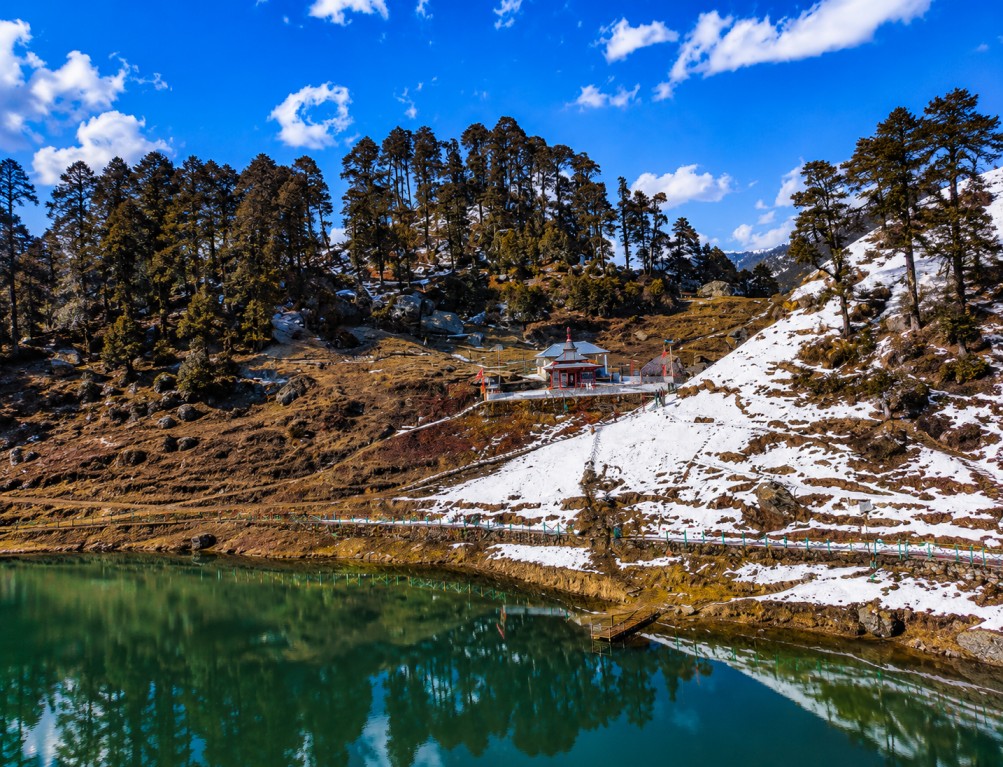
Serolsar Lake, a sacred mirror-still alpine lake near Jalori Pass
A high-altitude lake at 3,100 metres, reached by a forested 5-kilometre trail from Jalori Pass — locally revered, ecologically intact, and positioned as a single-day trek product or a two-destination pairing with the pass itself.
Landscape & Cultural Context
OverviewSerolsar Lake's water stays still and clear through the year, reflecting the surrounding deodar, oak, fir and pine cover along with the peaks beyond it — a condition that holds regardless of season, which is unusual for high-altitude lakes and useful to flag for photography-led itineraries.
Wildflowers line the trail in spring and summer; winter snow resets the entire setting into a different, whiter product. Either version photographs well, which gives operators a genuine year-round sell rather than a single peak-season window.
The lake carries active religious meaning for Kullu Valley communities, who hold it to be protected by Budhi Nagin, a local serpent goddess. The temple beside the lake is a working shrine, not a staged stop, and hosts annual fairs and ceremonies that are worth noting for cultural-calendar-based itinerary timing.
Local belief also holds that birds keep the lake's surface clear of fallen leaves — a detail guides use on-site and one that reinforces the site's framing as sacred rather than purely scenic.
Key Attractions
On and around the trailSerolsar Lake
The core product — still, clear water framed by dense forest, suited to slow-paced itineraries built around photography and quiet time rather than a quick photo stop.
Budhi Nagin Temple
An active shrine beside the lake with traditional Himachali architecture; visitors are expected to keep quiet and follow local custom on-site.
Jalori Pass Trailhead
The 5 km trail start point, with its own viewpoint value — bundles naturally as a single combined itinerary line with the lake.
Jibhi & Shoja
The nearest village bases for homestays, cafés and logistics support before or after the trek.
Tirthan Valley & Chehni Kothi
River valley and a landmark timber-and-stone tower, both workable as extension days on a multi-night circuit.
Great Himalayan National Park
Adjoining UNESCO World Heritage Site, relevant for biodiversity-focused or longer-format trekking programmes.
Activities & Seasonal Variation
Programming notesThe trek itself is moderate-grade and workable for beginners as well as experienced hikers, which widens the addressable client base. Winter converts the same trail into a snow-trekking product; summer and autumn keep it fully open for camping and multi-day forest itineraries.
Wildlife, Cuisine & Local Craft
Ground experienceWildlife — Forest cover around the lake and the adjoining Great Himalayan National Park support Himalayan black bear, barking deer, Himalayan monal, koklass pheasant, fox, langur, and a wide range of butterfly and bird species.
Cuisine — Jibhi and Shoja serve Himachali staples — Siddu, Dham, Madra, Babru, Chha Gosht, rajma, fresh trout, local honey and herbal teas — through village homestays and cafés.
Craft & retail — Jibhi, Banjar and Kullu town offer Kullu shawls, handwoven woollens, wooden handicrafts, Himachali caps, herbal goods, honey, dry fruit and artisan souvenirs as reference points for shopping-inclusive itineraries.
Access & Logistics
Routing reference| Mode | Nearest point | Distance / note |
|---|---|---|
| Air | Kullu–Manali Airport, Bhuntar | Approx. 65 km from the lake |
| Rail (broad gauge) | Chandigarh | Nearest broad-gauge railhead |
| Rail (narrow gauge) | Joginder Nagar | Nearest narrow-gauge railhead |
| Road + trail | Kullu, Banjar, Jibhi, Shoja → Jalori Pass | Followed by 5 km trek to the lake |
Seasonality Calendar
Route planningApril–June and September–November give the most stable trail conditions. December–February brings snowfall and a distinct winter trekking product, with occasional access restriction on heavy-snow days worth flagging in itinerary terms.