Loading...

Yumthang Valley : The Valley Of Flowers Of Sikkim

Trade Reference · Sikkim

Yumthang, the Valley of Flowers

A geographic and operational reference on Yumthang Valley, North Sikkim, compiled for tour operators, DMCs and itinerary planners building the rhododendron season into Himalayan programs.

Elevation 3,564 m
River system Teesta River
District North Sikkim
Base town Gangtok · 148 km
Rhododendron bloom calendar — Shingba Sanctuary
Mar — early bloom Apr — peak diversity May — late bloom Jun–Aug — green meadow Nov–Feb — snowbound
01 — Terrain

Landscape and geography


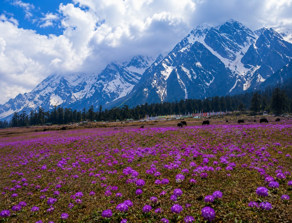
Yumthang sits in the upper reaches of the Teesta River valley at approximately 3,564 metres, presenting a broad open alpine meadow between forested hillsides and snow-covered ridgelines — a markedly different profile from the enclosed, forested lower valley that visitors pass through en route.

The glacial Teesta runs through the valley floor in swift channels, and the meadow margins support a dense concentration of rhododendron and alpine wildflower species, giving the terrain a layered character that shifts visibly with elevation and season.

02 — Ecology

Shingba Rhododendron Sanctuary


The valley lies within the Shingba Rhododendron Sanctuary, home to over two dozen rhododendron species blooming in successive waves between March and May, with different species flowering at different elevations — a detail relevant to timing multi-day treks that track the bloom upward through the sanctuary.

Higher reaches of the sanctuary and surrounding terrain support red panda, snow leopard and blue sheep, alongside a diverse range of high-altitude Himalayan bird species.

Rhododendron (24+ species) Red panda Snow leopard Blue sheep Blood pheasant Fire-tailed myzornis Laughingthrush species
03 — Sites

Key highlights


A small set of high-value stops anchor most itineraries through the valley, each suited to a distinct part of a day program.

Alpine meadow floor

The valley's most iconic feature — an open glacial meadow between forested slopes and snow ridgelines.

Shingba Sanctuary trails

Ascending routes through successive rhododendron elevation bands, with expanding valley views.

Yumthang hot springs

Naturally heated sulphur springs near the valley entrance, considered sacred locally.

Zero Point

Approximately 23 km beyond Yumthang at roughly 4,800 m — permanent snow and glacial terrain.

Lachung village

Gateway settlement on the approach road, home to Lepcha and Bhutia communities.

Teesta river channels

Swift glacial waterways running the length of the valley floor.

04 — Activity

Activities and programming


Programming at Yumthang centres on unstructured meadow and river-bank exploration, sanctuary trekking, birdwatching, and hot spring visits — relevant for operators sequencing a day or overnight stop within a broader North Sikkim circuit.

Meadow walking Sanctuary trekking Birdwatching Hot spring bathing Zero Point excursion Alpine photography River-bank exploration
05 — Season

Seasonal reference

 
Mar — May

Rhododendron bloom season; April marks peak species diversity. Most sought-after visiting window.

Jun — Aug

Lush green meadow, full glacial and monsoon flow on the Teesta; peaks frequently cloud-covered.

Nov — Feb

Heavy snowfall typically closes the North Sikkim road; valley largely inaccessible.

06 — Access

Travel logistics

 
Base town
Gangtok, approximately 148 km away via Mangan and Lachung; a 6–7 hour drive.
Nearest airport
Bagdogra Airport, West Bengal — approximately 124 km from Gangtok, with regular domestic connections.
Rail access
New Jalpaiguri (NJP) railway station in Siliguri, roughly the same road duration to Gangtok as Bagdogra.
Permits
An Inner Line Permit is required for North Sikkim and must be arranged in Gangtok in advance of travel.
More Places to Explore