Loading...

Berinag : Where Tea Gardens Meet Himalayan Views

Trade Reference · Uttarakhand

Berinag, tea slopes above the Kumaon Himalaya

A geographic and operational reference on Berinag, Pithoragarh district, compiled for tour operators, DMCs and itinerary planners building the offbeat Kumaon circuit.

Elevation ~1,860 m
District Pithoragarh
From Pithoragarh 88 km · ~3 hrs
Heritage Colonial tea estate
Hillside tea terraces — colonial-era estate layout
lower estate
 
mid slopes
 
upper terraces

Plantation rows established under British-era cultivation, still worked today, climb the hillside in narrowing bands toward the ridgeline.

01 — Terrain

Landscape and geography


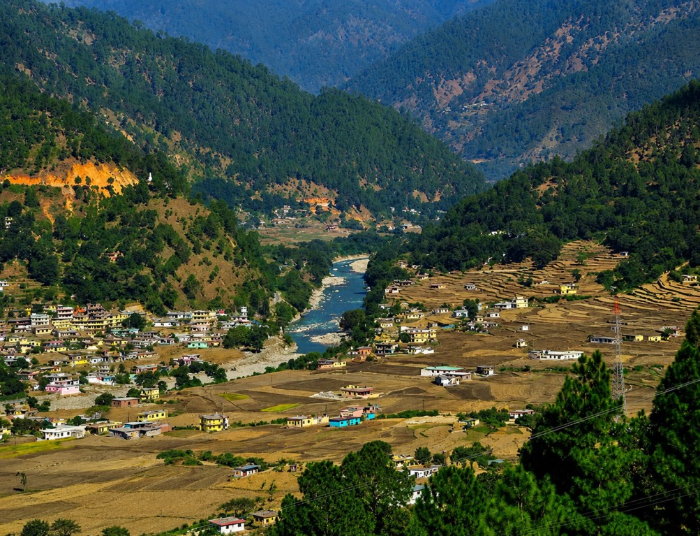
Berinag sits at approximately 1,860 metres, its slopes covered in emerald tea plantations, terraced fields and dense forest. Panoramic viewpoints around the town command sightlines to Nanda Devi, Trishul, Rajrambha and the Panchachuli range, with sunrise and sunset regarded as the most rewarding viewing windows.

The setting is notably uncrowded relative to more commercialised Kumaon hill stations, giving it a slower, more contemplative visitor pace.

02 — Heritage

History and cultural identity


The name Berinag derives from the Sanskrit word for snake, reflecting centuries of local mythology tied to serpent deities, the Nag Devtas. Local legend holds that the serpent deity Kaliya Nag settled in these hills after his encounter with Lord Krishna.

Alongside this mythological layer, Berinag carries a working colonial-era tea heritage: plantations established under British rule continue to produce regionally well-regarded tea, giving the town a combined agricultural and spiritual identity distinct from other Kumaon hill stations.

03 — Sites

Key attractions


Berinag also functions as a base for a wider set of Kumaon sites within comfortable day-trip range.

Berinag tea gardens

Colonial-era plantations still in production, open to walking visitors.

Nag Devta Temple cluster

Shrines to Dhaulinag, Kalinag, Feninag, Bashukinag, Pinglenag and Harinag.

Berinag Lake

A quiet spot for boating and fishing within the town itself.

Tripura Temple, Uttarayan

A short drive from town, a notable regional pilgrimage stop.

Chaukori & Didihat

Neighbouring viewpoints and towns reachable within the same touring day.

Patal Bhuvneshwar & Hat Kalika Temple

Cave shrine and temple sites forming part of the wider regional circuit.

04 — Activity

Activities and experiences


Programming centres on plantation walks, temple visits and viewpoint photography, with trekking and birdwatching available for operators building a more active day into the stop.

Tea garden walks Temple visits Trekking Birdwatching Sunrise / sunset viewpoints Boating & fishing
05 — Season

Seasonal reference

 
Mar — Jun

10–25°C, clear skies, best conditions for sightseeing and trekking.

Jul — Sep

Monsoon; lush landscapes but landslide risk on mountain roads.

Sep — Nov

Post-monsoon clarity, refreshed greenery.

Dec — Feb

Cold, misty conditions with occasional snowfall.

06 — Access

Travel logistics

 
From Pithoragarh
Approximately 88 km, around a 3-hour drive.
From Nainital
Approximately 160 km by road.
Rail access
Kathgodam or Tanakpur, roughly 130–170 km, with onward bus or taxi.
Nearest airport
Pantnagar, with limited flight options; further road travel required to reach Berinag.

 Complete Your Trip with Nearby Attractions