Loading...

Khaliya-Top-Base : Where Meadows Meets Snowy Peaks

Trade Reference · Uttarakhand

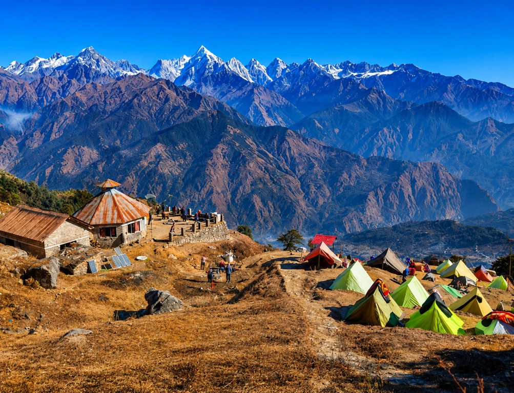
Khaliya Top, a Kumaon meadow viewpoint

A geographic and operational reference on Khaliya Top, above Munsiyari in Pithoragarh district, compiled for tour operators, DMCs and itinerary planners building the Kumaon Himalaya circuit.

Elevation 3,500 m
Base town Munsiyari
District Pithoragarh
Trek grade Beginner–moderate
Summit panorama — peaks visible on a clear day


Panchachuli Nanda Devi Nanda Kot Hardeol Rajrambha Trishul
01 — Terrain

Landscape and geography


Khaliya Top sits above Munsiyari at approximately 3,500 metres, presenting broad alpine meadows across rolling slopes bordered by oak, pine, rhododendron and deodar forest. The terrain shifts markedly with season, from rhododendron bloom in spring to full snow cover in winter.

From the summit meadow, sightlines extend across several of the highest peaks in the Indian Himalaya, making the site a reliable high-visibility viewpoint on clear days year-round.

02 — Context

History and cultural context


Khaliya Top lies within the Johar Valley, home to the indigenous Shauka (Bhotia) community. The region once carried active trade routes into Tibet, until the border closed in the mid-20th century, and local villages retain distinct architecture, festivals and craft traditions tied to that history.

Munsiyari and the surrounding area are positioned within Uttarakhand's broader eco-tourism framework, with an emphasis on low-impact, responsible travel through the fragile alpine ecosystem.

03 — Sites

Key attractions


Khaliya Top functions as an anchor point for a wider circuit of natural and cultural sites reachable from Munsiyari.

Khaliya Top meadow

The primary panoramic viewpoint, with uninterrupted sightlines to snow-clad peaks and valleys.

Khaliya Top Trek

A short, well-marked route from Munsiyari through forest and meadow, suited to varied trekker levels.

Birthi Falls

A regional waterfall stop along the Munsiyari approach road.

Thamri Kund & Darkot Village

A forest lake and a traditional Bhotia village within reach of the base town.

Kalamuni Temple

A hilltop temple stop en route between Thal and Munsiyari.

Panchachuli Base Camp & Milam Glacier

Extended trekking routes for operators building multi-day mountain programs.

04 — Activity

Adventure and outdoor programming


Trekking is the core activity, supplemented by strong winter-sport potential and meadow camping — relevant for operators packaging both short scenic treks and season-specific adventure add-ons.

Trekking Meadow camping Skiing Snow trekking Snowboarding Mountain biking Birdwatching Nature photography
05 — Culture

Wildlife, cuisine and craft


Surrounding forest supports musk deer, Himalayan black bear, barking deer, Himalayan fox, yellow-throated marten, Himalayan monal, koklass pheasant and seasonal migratory bird populations.

Munsiyari serves Kumaoni and Bhotia cuisine, and the local craft economy centres on wool, pashmina and honey.

Bhatt Ki Churkani Aloo Ke Gutke Kafuli Chainsoo Mandua Roti Bal Mithai Bhotia shawls Pashmina products Organic honey
06 — Access

Travel logistics

 
Nearest airport
Pantnagar Airport, approximately 310 km from Munsiyari.
Rail access
Kathgodam railway station, well connected to major Indian cities.
Road access
From Kathgodam, road travel to Munsiyari via Almora and Pithoragarh.
Trailhead
The Khaliya Top trek begins directly from Munsiyari; local guides are available.
07 — Season

Seasonal reference

 
Mar — Jun

Pleasant conditions, clear skies, rhododendron bloom along the trail.

Sep — Nov

Crystal-clear peak visibility and stable trekking conditions.

Dec — Feb

Snow cover across the meadow; suited to winter-sport programming.

      Complete Your Trip with Nearby Attractions