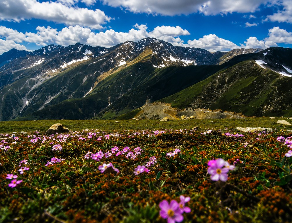
Sinthan Top
A mountain pass at roughly 3,700–3,800 metres in the Pir Panjal range, forming the link between the Anantnag district of South Kashmir and the Kishtwar region of Jammu. This reference outlines the approach route, seasonality, and access relevant to offbeat Kashmir itinerary planning.
Site character
Sinthan Top sits within the Pir Panjal range, forming a genuine mountain-pass link between South Kashmir and the Kishtwar region of Jammu, rather than a purpose-built tourist viewpoint. It is understood to be the second-highest motorable pass in the region after Harmukh, and retains a pastoral character historically shaped by shepherds and traders crossing between the Kashmir Valley and the Chenab Valley during the short summer window when the route is passable.
Snow persists at the pass for much of the year, including patches through summer, and the summit's 360-degree viewpoint takes in both the Kashmir and Jammu divisions, with the Pir Panjal and Zanskar ranges visible in the distance — a combination that positions Sinthan Top as an offbeat alternative to Kashmir's more heavily visited circuits.
Approach route
Srinagar
Starting point of the common approach route.
Awantipora
Early waypoint on the southbound route.
Anantnag
South Kashmir's district hub, ~73–80 km from the pass.
Kokernag
Natural springs and botanical gardens along the route.
Daksum
A tranquil health-resort valley before the final ascent.
Sinthan Top
360-degree viewpoint at the pass, ~3,700–3,800 m.
Points of reference
360-degree summit point
The pass's central attraction, offering sweeping views spanning both the Kashmir Valley and the Chenab Valley of Jammu.
Achabal Gardens
A Mughal-era garden along the approach route, offering a historical and horticultural stop en route to the pass.
Kokernag
Natural spring-fed gardens providing a mid-route rest and sightseeing point.
Remote lake access
The pass serves as a gateway to several remote alpine lakes in the surrounding mountains, of interest to trekkers extending beyond the main viewpoint.
On-site activity
Photography & sightseeing
The elevated 360-degree viewpoint is the central draw, particularly rewarding at sunrise and sunset.
Snow walks
Persistent snow patches at this altitude allow snow-based activity outside the core winter season, even into summer months.
Trekking
Routes through alpine meadows and boulder-strewn slopes suit moderately experienced trekkers seeking valley views beyond the summit.
Picnicking & stargazing
Day-trip relaxation is common among visitors from Anantnag and Srinagar, with clear night skies favouring overnight stargazing nearby.
Access requirements
- No direct public transport serves Sinthan Top; a hired taxi or private vehicle is the practical means of access.
- An SUV or similarly capable vehicle is recommended for the steep, narrow final stretch of road.
- Warm clothing is necessary even in the open season, given persistently cool to cold conditions at altitude.
- The route is only passable from roughly May to September/October; conditions should be confirmed before departure.
Seasonality
| Period | Conditions | Notes |
|---|---|---|
| MAY — SEP | Recommended | Most reliable travel conditions, with the road open and relatively stable weather. |
| LATE APR / OCT | Shoulder season | Road generally passable, though conditions are less predictable at the edges of the window. |
| NOV — MAR | Closed | Heavy snowfall closes the pass entirely until the following spring. |
Access & connectivity
Primary air access point; Jammu Airport is an alternative requiring a longer 210–330 km road journey via Batote and Kishtwar.
Both stations require onward travel by taxi or private vehicle to reach the pass.
The standard approach from Srinagar via Awantipora, Anantnag, Kokernag, and Daksum.
Complete Your Trip with Nearby Attractions