📍 Location
Approximately 37 kilometres north of Tawang, Arunachal Pradesh
⛰️ Altitude
Approximately 4,633 metres (15,200 feet)
🛂 Entry
Inner Line Permit (ILP) and Protected Area Permit required
🚙 Access
Only Arunachal Pradesh-registered vehicles permitted
🌄 Overview
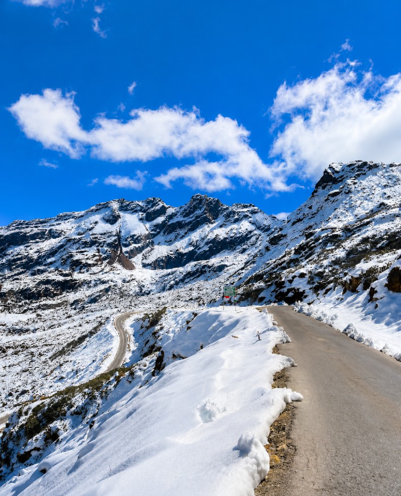
Bumla Pass is one of India’s most historically significant and emotionally powerful high-altitude destinations. Located approximately 37 kilometres north of Tawang in Arunachal Pradesh at an altitude of about 4,633 metres (15,200 feet), it marks the Line of Actual Control (LAC) between India and China. Surrounded by the rugged Eastern Himalayas, the pass combines breathtaking mountain scenery with immense historical, military, and geopolitical importance.
The pass is open only to Indian nationals and requires both an Inner Line Permit (ILP) and a Protected Area Permit issued in Tawang with approval from the Indian Army. Only Arunachal Pradesh-registered vehicles are allowed, and visitors must complete their journey before the designated cut-off time because weather conditions can change rapidly at high altitude. These regulations enhance the exclusivity and significance of the experience while ensuring visitor safety and security.
Bumla Pass has been an important route for centuries, connecting the Tawang Valley with Tibet through trade and Buddhist pilgrimage. It gained worldwide historical importance in March 1959 when the 14th Dalai Lama crossed into India through this pass while escaping Tibet. The pass later became one of the principal routes used by the Chinese People's Liberation Army during the 1962 Sino-Indian War, making it one of the most historically important locations along the Indo-China frontier.
🇮🇳 Why Visit Bumla Pass
The greatest attraction of Bumla Pass is its rare combination of natural beauty, patriotic significance, and historical depth. Standing beside the border marker with the Indian Tricolour flying against the backdrop of snow-covered Himalayan peaks creates a memorable experience filled with pride and respect. Visitors also have the opportunity to interact with Indian Army personnel stationed at one of the country's highest military posts, hear about their service, and enjoy refreshments at the Army café, adding a deeply personal dimension to the visit.
The drive from Tawang to Bumla is an unforgettable part of the journey. The route passes through spectacular Himalayan landscapes, army checkpoints, and scenic mountain roads while crossing famous attractions such as Madhuri Lake (Sangestar Tso) and PTSO Lake before reaching the border.
⭐ Key Highlights
🚩 Bumla Border Point
Bumla Border Point: The main attraction where the Line of Actual Control separates India and China. Visitors can view military installations, the border marker, and the Tibetan Plateau beyond while following Army photography regulations.
🤝 Border Personnel Meeting Point (BPM)
Border Personnel Meeting Point (BPM): One of the official locations where Indian and Chinese military officials conduct scheduled meetings to maintain border protocols and communication.
🏞️ PTSO Lake
PTSO Lake: A pristine high-altitude lake known for its crystal-clear reflections, peaceful atmosphere, and stunning Himalayan scenery.
💙 Madhuri Lake (Sangestar Tso)
Madhuri Lake (Sangestar Tso): Famous for its blue waters, standing dead trees, surrounding mountains, and picturesque landscape, making it one of Arunachal Pradesh's most photographed attractions.
🙏 Dalai Lama Escape Route
Dalai Lama Escape Route: The historic route used by the 14th Dalai Lama while entering India in 1959, giving the region exceptional historical and spiritual significance.
🎖️ Tawang War Memorial
Tawang War Memorial: Located in Tawang, this memorial honours Indian soldiers who sacrificed their lives during the 1962 Sino-Indian War and provides valuable historical context before visiting Bumla.
🚙 Activities
The drive to Bumla Pass is itself one of the highlights, offering spectacular views of snow-covered mountains, alpine terrain, and high-altitude lakes. At the pass, visitors can interact with Army personnel, learn about the Border Personnel Meeting Point, stand near the LAC, and experience the unique atmosphere of this remote frontier. Birdwatching, landscape photography within permitted zones, and relaxing with hot tea or soup at the Army café further enrich the experience.
🌤️ Best Time to Visit
The ideal time to visit Bumla Pass is from May to October, when the road remains largely accessible and weather conditions are comparatively stable. May and June offer snow-covered landscapes and excellent visibility, while October provides crystal-clear post-monsoon views. Monsoon months may bring clouds and occasional road disruptions, while heavy snowfall usually makes the pass inaccessible between November and April. Visitors should begin their journey early in the morning and carry warm layered clothing throughout the year due to the extreme cold.
🛣️ Connectivity
Bumla Pass can only be reached from Tawang, approximately 37 kilometres away. Travel is permitted only in locally registered four-wheel-drive vehicles arranged through hotels or travel operators in Tawang. Visitors must obtain both an Inner Line Permit and a Protected Area Permit, while foreign nationals are not permitted to visit due to the military sensitivity of the border area.
Tawang is connected by road from Guwahati via Tezpur, Bhalukpong, Bomdila, Dirang, and Sela Pass. The nearest major airport is Lokpriya Gopinath Bordoloi International Airport in Guwahati, while Tezpur Airport offers limited domestic connectivity. Careful advance planning is essential to complete permit formalities and ensure a safe and memorable visit to this remarkable Himalayan frontier.
Best places around destination
```