01 — Terrain
Setting and landscape
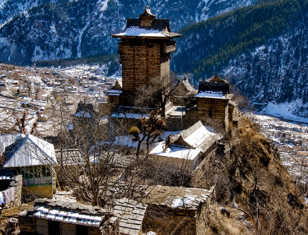
Kamru Fort stands on a hilltop above Kamru Village, roughly 2 km from Sangla, at approximately 2,600 metres, overlooking the Baspa Valley. Snow-covered peaks, pine and deodar forest, apple orchards and terraced farmland surround the site, with the Baspa River running through the valley below.
The approach passes through the village's narrow lanes, lined with traditional carved wooden houses. From the fort's upper levels, the outlook extends across Sangla Valley, neighbouring settlements and forested ridgelines — one of the more complete viewpoints in Kinnaur.
02 — Heritage
History and religious significance
Kamru Fort is estimated to be over a thousand years old and served as the original capital of the Bushahr Kingdom before the royal seat relocated to Sarahan. In its active period, the fort held a role in defending the region and controlling Himalayan trade routes.
The complex houses the Kamakhya Devi Temple, whose idol is believed to have been brought from Assam, and which remains an active pilgrimage site for the people of Kinnaur today. Entry to certain temple areas may require visitors to wear a traditional Kinnauri cap or shawl, provided on site.
c. 1,000+ years ago
Fort established as capital of the Bushahr Kingdom.
Later period
Bushahr capital relocated to Sarahan; Kamru retains religious significance.
Present day
Kamakhya Devi Temple remains active; Kath-Kuni structure preserved.
03 — Sites
Attractions on and around the fort
The fort itself anchors a short heritage circuit through Kamru Village and onward into the wider Sangla-Chitkul corridor.
Kamru Fort
Multi-storey timber-and-stone structure with carved wooden balconies and a slate roof.
Kamakhya Devi Temple
Sacred shrine within the fort complex, an active pilgrimage site for Kinnauri communities.
Kamru Village
Stone pathways and centuries-old wooden homes housing a living local community.
Sangla & Chitkul
Neighbouring valley towns forming the core of the wider Kinnaur circuit.
Batseri & Rakchham
Traditional villages along the Baspa Valley, reachable within the same touring day.
Baspa River & Bering Nag Temple
Riverside scenery and a further regional temple stop near Sangla.
04 — Activity
Activities and experiences
The visit combines a short uphill approach walk through orchards and village lanes with wider trekking and cultural-exploration options across the Baspa Valley — well suited to heritage-focused and soft-adventure itineraries alike.
Heritage walking route Village exploration Trekking Birdwatching Mountain photography Temple visit
05 — Culture
Wildlife, cuisine and craft
Surrounding forest supports Himalayan monal, musk deer, red fox and, in remoter reaches, Himalayan black bear, alongside various pheasant and mountain bird species.
Sangla and neighbouring villages serve Kinnauri specialities and a local craft economy built on woollen textiles and woodwork.
Siddu Thukpa Chha Gosht Madra Babru Kinnauri shawls Woollen garments Wooden handicrafts
06 — Access
Travel logistics
Nearest airport
Shimla Airport (Jubbarhatti); Chandigarh International Airport is the nearest major airport.
Rail access
Kalka is the nearest broad-gauge station, followed by road via Shimla, Rampur and Reckong Peo to Sangla.
Road access
Regular bus and taxi connections link Sangla with major Himachal Pradesh towns.
On-site approach
Short uphill walk from Sangla through village lanes; comfortable walking shoes recommended.
07 — Season
Seasonal reference
Apr — Jun
Pleasant weather, orchards in bloom, roads easily accessible.
Sep — Oct
Clear conditions and golden autumn foliage across the valley.
Nov — Mar
Snowfall across the fort and village; occasional road disruption.
Complete Your Trip with Nearby Attractions