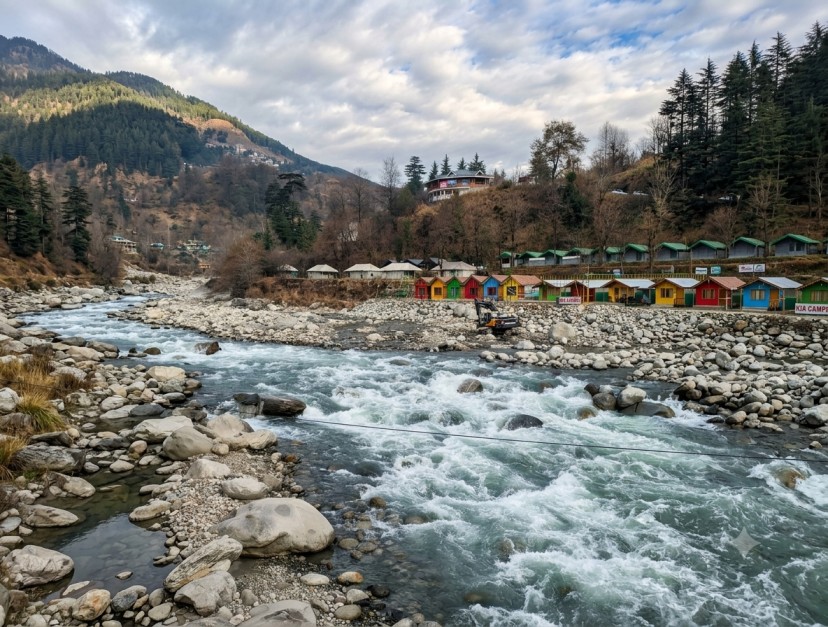
Satpuli
A riverside stop at the confluence of the Nayar East and Nayar West rivers, positioned almost exactly midway between Kotdwar and Pauri — a natural resupply and pause point for road-based Garhwal itineraries.
Overview
Sector: Pauri Garhwal DistrictSatpuli sits close to the confluence of the Nayar East and Nayar West rivers, at an elevation of roughly 657 to 900 metres, almost exactly midway along the Kotdwar–Pauri route. The setting is defined by meandering rivers, terraced valleys and forested hillsides, with distant views toward the snow-capped Himalayan ranges.
The town's name is understood to derive from "Sat Pul," a reference to seven bridges that once carried the route toward Kotdwar, reflecting its long-standing function as a crossing and gathering point for surrounding villages.
Two additional factors shape Satpuli's role in a Garhwal itinerary: its history of rebuilding following a major flood in 1952, and its standing as a settlement home to a number of retired Garhwal Rifles personnel. Together with its riverside setting, this positions Satpuli as a resupply and rest stop with genuine local texture, distinct from more built-up hill stations along the same route.
Destination Rationale
Itinerary FitFactors relevant to positioning Satpuli within a Kotdwar–Pauri road itinerary or wider Garhwal programme.
- Ecology River confluence — Nayar East and Nayar West meet near the town and continue to the Ganges at Banghat; supports freshwater eel, spotted catfish, river carp, crabs, water birds and occasional otter sightings.
- Route Midpoint stop — positioned on NH 119, roughly 50–54 km from both Kotdwar and Pauri, functioning as a natural break point on road transfers between the two.
- Faith Temple cluster — Kandoliya Temple above the town, plus Jwalpa Devi, Bhuvaneshwari Devi and Dangleshwar within the surrounding hills, active particularly during Navratri.
- Circuit Lansdowne access — approximately 30 km by hill road, extending a Satpuli stop into one of Uttarakhand's cantonment hill stations.
Site Index
4 Reference PointsNayar Confluence
Meeting point of the Nayar East and Nayar West rivers, continuing onward to join the Ganges near Banghat; the natural centrepiece of the town.
Kandoliya Temple, Satpuli
Hilltop shrine dedicated to Goddess Sati and Lord Shiva, overlooking the town and surrounding valleys.
Jwalpa Devi / Bhuvaneshwari Devi / Dangleshwar
Cluster of forested-hill temples drawing district-wide pilgrimage, with peak footfall during Navratri.
Lansdowne
Approximately 30 km by winding hill road; a quiet cantonment town with oak and pine forest and associated jungle-safari access.
Activity Matrix
Ground Operations Reference| Activity | Location / Route | Operating Note |
|---|---|---|
| Fishing / angling | Nayar East and Nayar West rivers | Freshwater eel, catfish and carp present; core draw for river-focused itineraries. |
| River picnics | Riverbank sites near the confluence | Low-logistics, family-suitable activity with minimal setup requirement. |
| Nature walks | Forested hills of the Nayar Valley | Seasonal wildflower and bird activity; suitable for short guided walks. |
| Camping / rafting / kayaking | Nayar River corridor | Emerging activity category; operator infrastructure still developing, confirm capacity ahead of booking. |
Seasonality Data
Planning Reference| Period | Conditions | Note |
|---|---|---|
| March – June | Pleasant, stable | Optimal window for sightseeing, river activities and short treks. |
| September – November | Pleasant, stable | Second peak window, following monsoon withdrawal. |
| December – February | Mild by regional standard | Lower elevation than Pauri/Lansdowne keeps winters comparatively comfortable. |
| Monsoon (Jul – Aug) | Swollen rivers, slippery roads | Increased caution required for road transfers and riverbank activity. |
Access & Connectivity
Logistics ReferencePositioned directly on the Kotdwar–Pauri route, with onward road link to Banghat; regular buses and taxis pass through the town.
Nearest railhead is Kotdwar; distance varies by source. Onward movement to Satpuli by bus or taxi.
Jolly Grant Airport, Dehradun, providing primary air connectivity for arrivals from other parts of India.
Complete Your Trip with Nearby Attractions